As the need to understand air quality around the world becomes evermore prevalent agencies such as TCEQ are looking to new, yet proven technologies such as the mobile real-time DV3000 gas analyser to monitor fleeting emission events which may included BTEX gases like benzene that current ‘reference’ equipment may not detect. For further information on how Duvas Technologies can help with your monitoring needs contact us at enquiries@duvastechnologies.com.
See below TCEQ’s press release 10/11/2020:
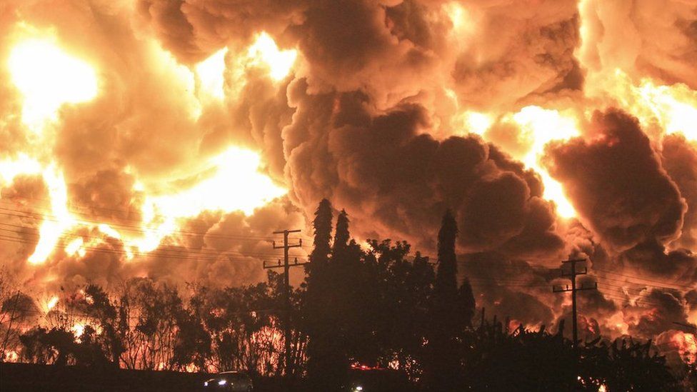
HOUSTON – The Texas Commission on Environmental Quality’s ability to detect airborne pollution following hurricanes and other disasters has taken a significant stride forward with a series of additions and enhancements to its emergency response assets, officials announced today.
State lawmakers approved nearly $1 million in 2019 to upgrade two existing TCEQ mobile air monitoring vans and purchase a third—a SMART (Strategic Mobile Air Reconnaissance Technology) Rapid Assessment Survey van—that allows the agency to greatly expand the number of pollutants it monitors and more quickly analyze results.
All three vehicles will help TCEQ better monitor air quality in densely industrialized areas like the Houston Ship Channel, the Beaumont-Port Arthur area, and Corpus Christi’s Refinery Row.
TCEQ Executive Director Toby Baker said the infusion of funds marks “a significant investment in proven technology” that will aid investigators’ efforts to locate concentrations of emissions following hurricanes, fires, and other disasters.
Officials unveiled the new SMART van and one of the upgraded vehicles today at an event in Houston’s Hartman Park.
“This is cutting edge technology,” said Cory Chism, deputy director of the Monitoring Division in TCEQ’s Office of Compliance and Enforcement. “These vehicles are nimble and sophisticated.”
The vans augment a network of over 200 air monitoring stations across the state, maintained by TCEQ and its partners, equipped with more than 400 individual air quality monitors.
TCEQ’s Regional Offices also deploy advanced handheld monitors, which take instantaneous readings of pollutants that reflect air quality at a particular location, to assist their investigations.
An upgraded version of the handheld devices—now capable of isolating benzene, critical for monitoring areas such as the Ship Channel—are especially useful in the wake of hurricanes, when stationary monitors may have been taken offline to protect agency assets.
To further enhance its surveillance capabilities following disasters, TCEQ recently purchased four unmanned aircraft systems, aka drones.
TCEQ obtained a Mavic 2 Pro Drone with smart controllers, a Mavic 2 Zoom UAS, and two Phantom 4 Pro + V2.0 UAS, along with a DroneSense Software Platform that will allow live stream video during disaster events. TCEQ is planning to expand the fleet and send a Mavic 2 Zoom UAS and a Mavic Mini UAS to seven of its Regional Offices.
The drones will provide “a new platform for situational awareness during emergency responses,” Baker said. “Having eyes in the sky after these events will be useful, without putting our staff in danger.”
TCEQ personnel also provided demonstrations of the drones and the handheld monitors at Tuesday’s event.
The two upgraded mobile air monitoring vans feature advanced mass spectrometers capable of sampling more than 1,000 pollutants, including formaldehyde, nitrogen oxide, sulfur oxide, methane, and ozone, among others. These and other instruments will allow agency investigators to quickly sample pollutant hot spots, map air concentrations in an area, and identify locations for sampling over longer durations.
The new Rapid Assessment Survey van, which Chism said pulls in air “like a vacuum cleaner,” can measure 16 different pollutants and analyze results in real time while driving up to 35 mph.
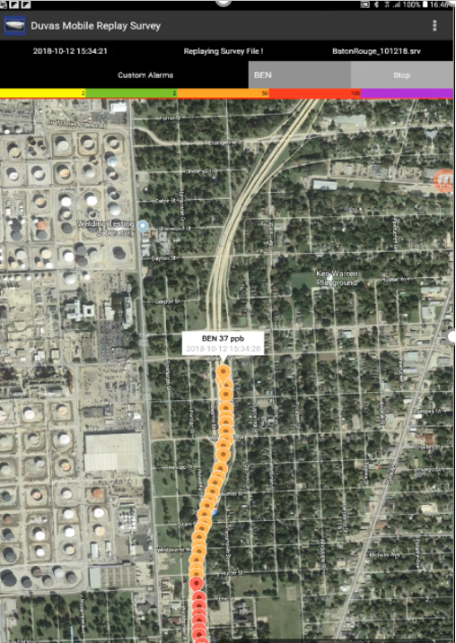
Chism said the SMART van had a trial run recently when it was successfully deployed to assist TCEQ’s air monitoring efforts in the wake of Hurricane Laura, noting that software and an app unique to the vehicle produced color-coded animation that illustrated concentrations of pollutants along survey routes.
The equipment adds a new dimension to TCEQ’s ability to make monitoring data quickly available to the public, Chism added. For example, agency investigators tweeted live updates of the animations while measuring pollutants following Laura—known as “caterpillar trails”—from surveyed locations.
“The instrument also has a GPS system built into it, so every time you get a SO₂ reading, for example, you also get a GPS coordinate, which tells you exactly where the concentrations are,” he noted.
TCEQ has posted video files of the air monitoring vans, handheld monitors, drones, and stationary air monitors.
